Macclesfield Flood Risk Management Plan (FRMP2)
A Flood Risk Management Plan or FRMP is a national, strategic plan that has actions for identified flood risk areas.
They are published by the Environment Agency who work closely with Lead Local Flood Authorities and other Risk Management Authorities to produce them.
There is a statutory duty for all Lead Local Flood Authorities who have identified a Flood Risk Areas to create and implement a mitigation plan to be included in the national Flood Risk Management Plan. This requirement has subsequently been superseded, although the commitments to existing Flood Risk Management Plans (FRMPs) remain.
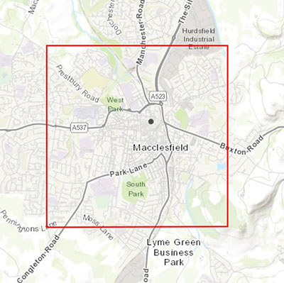
Cheshire East Council is a Lead Local Flood Authority and the Macclesfield Flood Risk Area is included in the current national Flood Risk Management Plan strategy. The map below shows the extent of the project.
What we are doing
Areas of Macclesfield have a high risk of flooding from surface water and ordinary watercourse flooding, in part due to an aging network of unmapped, culverted watercourse buried underground.
Working with the local risk management authorities; 4 objectives were agreed to mitigate local flood risk in the Macclesfield flood risk area:
- By 2025 the Lead Local Flood Authority supported by the Environment Agency will increase awareness of flooding, the Flood Warning Service, boost community resilience and educate the community on riparian ownership for the Macclesfield Flood Risk Area. This includes being part of the Environment Agencies National Flood Awareness Campaign in October/November 2020 and improving the uptake of the Flood Warning Service by 20%.
- By 2024 the Lead Local Flood Authority with support from United Utilities will manage development / redevelopment opportunities by mapping Sustainable Urban Drainage Systems (SUDS) and de-culverting/daylighting opportunities for within the Macclesfield Flood Risk Area to further encourage the use of Green SUDS . Promoting channel daylighting where opportunities exist.
- By 2025 the Lead Local Flood Authority and United Utilities will develop a better understanding of the scale of risk in Macclesfield posed from the condition and capacity of culverted ordinary watercourses, highlighting the areas thought to be at most risk for the Macclesfield Flood Risk Area to develop a Surface Water Management Plan.
- By 2024 the Environment Agency and the Lead Local Flood Authority will consider areas for potential Water Framework Directive 2000 (WFD) improvements for the Macclesfield Flood Risk Area to develop opportunity mapping identifying potential areas for such improvements.
Progress to date
- CCTV survey has been undertaken in the catchment associated with a tributary of the River Bollin in the Ryle’s Pool area.
- The SuDs supplementary planning document has been published
- Environment Agency National Flood Awareness campaign 2020
- Early engagement with the South Park masterplan
- A number of opportunities for daylighting have been identified and discussed with United Utilities – funding sources have yet to be identified although we are actively bidding for national funding.
- Funding has been secured for culvert improvement works Ryle’s Pool area.
Next steps 2024/25
- We are looking to hold a public engagement event, a date will be published once details are confirmed
- Letter drops to residents will be carried out to provide information on flooding and how to be prepared
- Develop a better understanding of the location and condition of culverted watercourses
- Further survey work of culverted watercourses
- Develop a surface water management plan
- Continue to encourage the use of Green SUDS in new developments
- Continue to promoting channel daylighting where opportunities exist are part of new developments
What to do if there is a watercourse on, under or near your land
For more details see guidance owning a watercourse and further advice on the Councils approach to managing these watercourses can be found on our Flood risk management page.
Page last reviewed: 11 June 2024
Thank you for your feedback.