Open spaces assessment
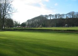
Paragraph 16 of the 2026 NPPF deals with Promoting healthy communities. A key objective is to promote the creation of healthy and inclusive places and support the provision of appropriate public services, by enabling development which can support this aim and seeking to retain, improve and deliver new facilities which are important for community wellbeing and minimising inequalities.
'Access to a network of high quality open spaces and opportunities for sport and physical activity is important for the health and well-being of communities, and can deliver wider benefits for nature and support efforts to address climate change. Planning policies should be based up-to-date assessments of the need for open space, sport and recreation facilities (including quantitative or qualitative deficits or surpluses) and opportunities for new provision. Information gained from the assessments should be used to determine what open space, sport and recreational provision is needed, which plans should then seek to accommodate'. The NPPF requires evidence-led planning and standards for local decision-making but it now gives greater recognition to national standards, referencing Fields in Trust Standards, Natural England Green Infrastructure Framework and Sport England Assessing and Playing Pitch Strategy Guidance.
The Cheshire East Open Space Assessment has combined existing data sources from previous surveys and carried out a new comprehensive survey of all the sites within the main 24 settlements listed in the council's Local Plan. All the sites are contained within a database with corresponding digital mapping.
The Introductory Report explains the structure and content of each open space summary report. The 11 open space summary reports and associated maps cover the 11 KSCs : Alsager, Congleton, Crewe, Handforth, Knutsford, Macclesfield, Middlewich, Nantwich, Poynton, Sandbach and Wilmslow. In additional there is a report covering the 13 LSCs .
The summary reports will be updated in 2027 as part of a comprehensive Open Spaces Assessment Audit currently being undertaken during 2026. The updates will be added to this page in due course.
Key service centres open spaces summary reports March 2012
- Introductory report (PDF, 242KB)
- Alsager summary report (PDF, 570KB ) and Alsager open space map (PDF, 503KB)
- Congleton summary report (PDF, 731KB) and Congleton open space map (PDF, 1.18MB)
- Crewe summary report (PDF, 1.02MB), Crewe north open space map (PDF, 754KB) and Crewe South open space map (PDF, 1.24MB)
- Handforth Summary Report (PDF, 401KB) and Handforth open space map (PDF, 1.17MB)
- Knutsford summary report (PDF, 545KB) and Knutsford open space map (PDF, 969KB)
- Macclesfield summary report (PDF, 1.23MB), Macclesfield North open space map (PDF, 1.35MB) and Macclesfield South open space map (PDF, 1.14MB)
- Middlewich summary report (PDF, 524KB) and Middlewich open space map (PDF, 894KB)
- Nantwich summary report (PDF, 616KB) and Nantwich open space map (PDF, 508KB)
- Poynton summary report (PDF, 533KB) and Poynton open space map (PDF, 540KB)
- Sandbach summary report (PDF, 755KB) and Sandbach open space map (PDF, 968KB)
- Wilmslow summary report (PDF, 719KB) and Wilmslow open space map (PDF, 1.18MB)
Local service centres document reports March 2012
- Local service centres open spaces summary report (PDF, 555KB)
- Alderley Edge appendices (PDF, 208KB) and Alderley Edge open space map (PDF, 455KB)
- Audlem appendices (PDF, 202KB) and Audlem open space map (PDF, 295KB)
- Bollington appendices (PDF, 233KB) and Bollington open space map (PDF, 472KB)
- Bunbury appendices (PDF, 198KB) and Bunbury open space map (PDF, 257KB)
- Chelford appendices (PDF, 116KB) and Chelford open space map (PDF, 275KB)
- Disley appendices (PDF, 210KB) and Disley open space map (PDF, 656KB)
- Goostrey appendices (PDF, 199KB) and Goostrey open space map (PDF, 520KB)
- Haslington appendices (PDF, 203KB) and Haslington open space map (PDF, 336KB)
- Holmes Chapel appendices (PDF, 207KB) and Holmes Chapel open space map (PDF, 426KB)
- Mobberley appendices (PDF, 201KB) and Mobberley open space map (PDF, 260KB)
- Prestbury appendices (PDF, 205KB) and Prestbury open space map (PDF, 970KB)
- Shavington appendices (PDF, 203KB) and Shavington open space map (PDF, 340KB)
- Wrenbury appendices (PDF, 230KB) and Wrenbury open space map (PDF, 239KB)
Page last reviewed: 02 September 2026
Thank you for your feedback.